
11 - THE ROUTE THROUGH THE LANDS OF THE GAIÀ RIVER, A BORDER TERRITORY (5 DAYS)
Day 1. Santa Coloma de Queralt – Pontils – Santa Perpètua de Gaià – Querol
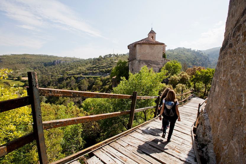
The route starts in the stately town of Santa Coloma de Queralt, where the springs of the Gaià River rise. Getting lost in its medieval streets full of chivalric tales and stepping into the Castle of the Counts of Queralt is like travelling through a time tunnel. Would you like to see what a genuine defence tower looked like? Following the course of the Gaià, you first reach the Castle of Pontils, now in ruins; and then Santa Perpètua de Gaià, uninhabited today but still home to a 15-metre tower. The day ends in Querol, where, besides visiting the old 5th-century castle, which still has its walls, arches and round towers, you can recharge at a first-class inn and stopover.
Distance: 17 km
Elevation: +300 m -440 m
Duration (approx.): 5 h 20 min (walking time)
Difficulty level (colour): medium level - blue
Route link on Wikiloc: https://es.wikiloc.com/rutas-senderismo/rutestop-t02-1-la-ruta-de-les-terres-del-riu-gaia-territori-de-frontera-120271006
Day 4. Santes Creus – Aiguamúrcia – Vila-rodona – Bràfim – Vilabella
On the penultimate day, the route leaves Santes Creus and takes us first to Aiguamúrcia, where along the way you can admire the dry-stone constructions, an art declared Intangible Cultural Heritage of Humanity by UNESCO. In Vila-rodona, did you know the town became a film set for shooting the movie 'El cafè de la Marina'? Here we also recommend a visit to the Museu de la Vila, the 2nd-century AD Roman columbarium, and the Modernista winery, the work of Gaudí's disciple, Cèsar Martinell. In Bràfim, you can visit the hermitage of Nostra Senyora de Loreto and admire its Neo-Romanesque architecture; while in Vilabella, the end of the stage, there are three museums to visit: the Pinacoteca Mossèn Romà Comamala, the Museu del Camp and the Sala de Paleontologia.
Distance: 14 km
Elevation: +80 m -120 m
Duration (approx.): 4 h 20 min (walking time)
Difficulty level (colour): medium level - blue
Route link on Wikiloc: https://es.wikiloc.com/rutas-senderismo/rutestop-t02-4-la-ruta-de-les-terres-del-riu-gaia-territori-de-frontera-120271160
Description
A five-day route that follows the course of the Gaià River from its source in Santa Coloma de Queralt to its mouth on the Mediterranean, through three comarques: the Conca de Barberà, the Alt Camp and the Tarragonès. Below, we highlight a series of suggestions to make this trekking route even more appealing and to help you combine it with the different attractions you will come across along the way.
Day 2. Vallespinosa – Selmella – Saburella – Querol
The second day follows the old paths of soldiers, attackers and defenders that link the castles of Vallespinosa, Selmella and Saburella, where you can also discover the old dovecote where pigeons were fed; they were the equivalent of today's WhatsApps, as they were used to send messages. The day ends once again in Querol.
Distance: 15 km
Elevation: +500 m -600 m
Duration (approx.): 4 h 40 min (walking time)
Difficulty level (colour): medium level - blue
Route link on Wikiloc: https://es.wikiloc.com/rutas-senderismo/rutestop-t02-2-la-ruta-de-les-terres-del-riu-gaia-territori-de-frontera-120271062
Day 3. Querol – Pont d’Armentera – Santes Creus
Leaving Querol and continuing along the Gaià River, we reach Pont d’Armentera, where we suggest visiting the Parish Church of Santa Magdalena to admire its magnificent Baroque altarpiece (1702) in polychrome and gilded wood, one of the sculptural jewels of the comarca. In Pont you will also discover the Roman aqueduct that carried water to Tarraco, restored in the 18th century. The stage ends in Santes Creus, home to one of the jewels of the Cistercian order, the Royal Monastery of Santes Creus. How about taking part in the activity 'A Path of Legends' and visiting the monastery accompanied by a monk? Santes Creus also has a large and excellent choice of restaurants. Enjoy your meal!
Distance: 13 km
Elevation: +150 m -400 m
Duration (approx.): 4 h (walking time)
Difficulty level (colour): medium level - blue
Route link on Wikiloc: https://es.wikiloc.com/rutas-senderismo/rutestop-t02-3-la-ruta-de-les-terres-del-riu-gaia-territori-de-frontera-120271090
Day 5. Vilabella – Renau – Catllar – River mouth
The last stretch of the route follows the Gaià downstream to its mouth. After Vilabella we come to Renau, the smallest town in the Tarragonès, which lives up to the saying that good things come in small packages (literally, "good jam comes in a small jar"). Did you know that one of its main tourist attractions is its religious buildings? Renau treasures architectural elements ranging from the Gothic church of Santa Maria de Peralta to the Modernista details by Josep Maria Jujol at the hermitage of the Mare de Déu de Loreto. In Catllar, and all the more so after completing this route, you simply must visit the Castle of Catllar, home to the Interpretation Centre of the Castles of the Baix Gaià. Before reaching the river mouth, the journey has one more surprise in store, l’Hort de la Sínia, an agroecological farm converted into an Environmental Education Centre. What a treat!
Distance: 20.5 km
Elevation: +100 m -350 m
Duration (approx.): 6 h 10 min (walking time)
Difficulty level (colour): high level - red
Route link on Wikiloc: https://es.wikiloc.com/rutas-senderismo/rutestop-t02-5-la-ruta-de-les-terres-del-riu-gaia-territori-de-frontera-120271242